|
#1
 06-24-2008, 08:55 PM
|
||||
|
||||
|
A few aids for weather, wind and waves along the SE coast appear below:
 CLICK ON: http://www.srh.noaa.gov/mfl/marine/ Marine Forecast (NOTE and click on weather hazards that show up) and Click on http://www.srh.noaa.gov/mfl/ for land forecasts, rain chance, warnings, etc. NWS Storm Prediction Center http://www.spc.noaa.gov/  http://www.spacecoastweather.org/wxradaramx.php  Regional radar From: http://www.intellicast.com/National/...ation=USFL0244  Incoming systems on national synoptic map From: http://www.wpc.ncep.noaa.gov/nationa...st/natfcst.php 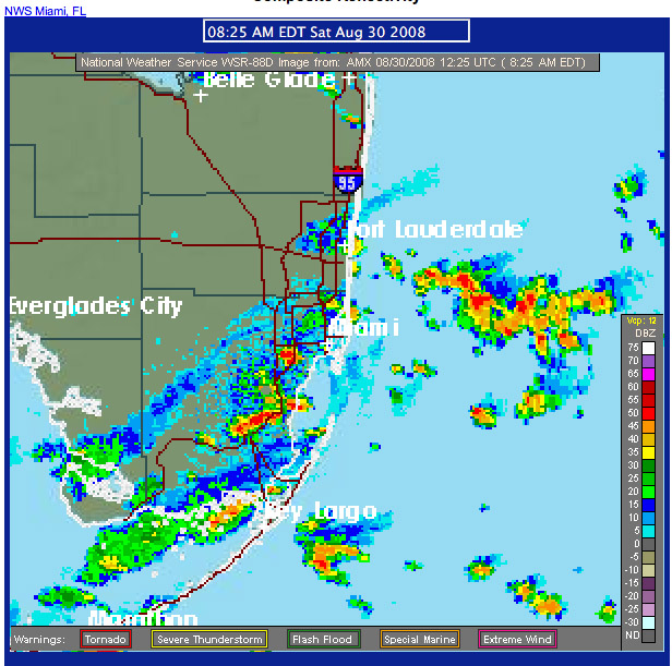 (Not Live Image) ** CLICK FOR CLOSER VIEW OF RADAR, PLEASE USE THIS FOR BETTER RESOLUTION 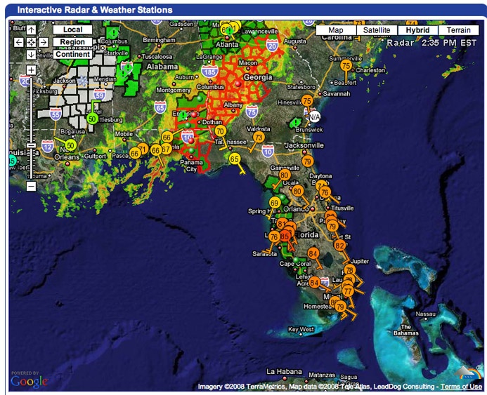 Click image to go to the Weatherunderground site shown above  Satellite From: http://weather.sun-sentinel.com/glob...Satellite.html  http://radar.weather.gov/Conus/RadarImg/southeast.gif Realtime Wind http://www.windonthewater.com/ http://www.ikitesurf.com/windandwher...ction=Gmap+Obs http://www.srh.noaa.gov/tbw/html/tbw...neWeather.htm#  http://www.sailwx.info/wxobs/windspe...254&radius=500 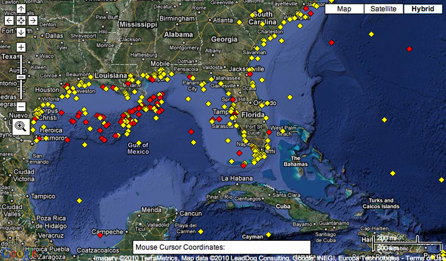 Click on image for active site Wave forecast  CLICK ON: http://dadecosurf.com/nww3_height http://magicseaweed.com/?region=20 The active images shown above should auto update in time. A collection of NOAA weather data: http://www.nws.noaa.gov/om/marine/swatlanticbrief.shtml The eastern edge of the Gulfstream in the Keys, an index of visibility in the offshore waters: http://www.srh.noaa.gov/rtimages/key/gulfstream.png
__________________
FKA, Inc. transcribed by: Rick Iossi Last edited by ricki; 05-03-2016 at 10:55 AM. 
|
|
|


 Threaded Mode