|
|
|
#1
 07-09-2010, 05:53 AM
|
||||
|
||||
|
Hey Eric, can you see the aerojack reef on a clear day, it might show up pretty well? Nice view you have up that way. I have some great cloud EVO shots from your beach from last week, been meaning to process and put them up.
__________________
FKA, Inc. transcribed by: Rick Iossi 
|
|
#2
07-09-2010, 08:38 AM
|
|||
|
|||
|
|
|
#4
07-12-2010, 10:14 AM
|
||||
|
||||
|
How to find the jacks and barge? As recent experience has shown, they can be hard to find at times! Range marks should fix that.
If you have a boat with a GPS, you should be able to head to these coordinates. You can check this on google earth. Nearshore end of Erojacks: 26 06' 37.21" N, 80 05' 57.17" W Barge wreck: 26 06' 44.40" N, 80 05' 50.55" W If you don't have a GPS, you can use the following range marks: 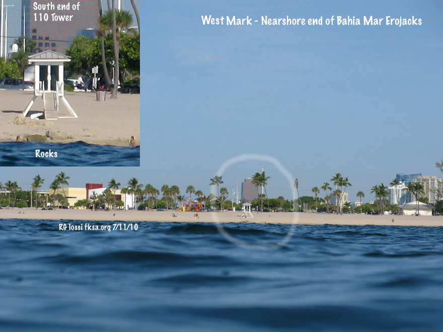 The west mark for the nearshore or western end of the Erojack groin. Line up the former New River Inlet jetty remnants with the south side of 110 Tower. As long as they don't move the lifeguard tower you can use that too but there's a good chance it will be moved. This takes you to the eastern edge of a small reef ledge that drops into the sand channel. You could run out or in on this mark until the north mark intersects. You could track the south mark too but it is less senstive (accurate). 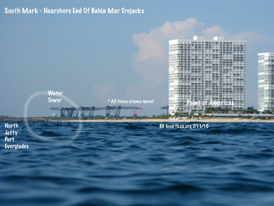 The south mark for the nearshore or western end of the Erojack groin. Try to place the water tower over the western portion of the north jetty to Port Everglades. Thought the container cranes would make nice range points, trouble is they're on tracks and can move a lot! This is a less sensitive range mark than the western or northern marks.  The north mark for the nearshore or western end of the Erojack groin. Just line up the western edge of the building with the third roof feature of the Portofino (?) condo over by Sunrise Blvd.. Copyright FKA, Inc. 2010 All rights reserved.
__________________
FKA, Inc. transcribed by: Rick Iossi Last edited by ricki; 07-12-2010 at 10:34 AM.
|
|
#5
07-12-2010, 10:19 AM
|
||||
|
||||
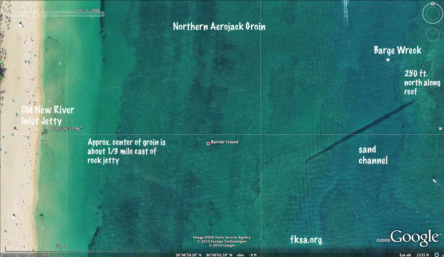 An overview of the layout of things. Here are the range marks for the barge wreck. The wreck is about 335 ft. north of the jacks on a west facing low reef ledge. This ledge is about 75 ft. west of the seaward end of the Erojack groin.  The west mark for the barge wreck. Just line up the south edge of the Bahia Mar tower with that roof feature of the Sunsentinel building downtown.  The south mark for the barge wreck. Just line up the water tower over the end of the Port Everglades jetty. This mark along with the west mark should drop you right on the barge.  The north marks for the barge wreck. There are two intersections for this one as noted with the "*." 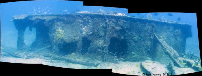 Just aft of the barge bow looking west. Click photo for full sized image. Copyright FKA, Inc. 2010 All rights reserved
__________________
FKA, Inc. transcribed by: Rick Iossi
|
|
#6
08-01-2010, 10:17 PM
|
||||
|
||||
|
A short segment scooter free diving over the jacks at night a few days ago.
Lots of amorous trumpet fish?! p.s. - shot this with a $105. 400 lumen movie light along with my Canon G9? So, the framing is shaky being hand held while free diving. Could be improved using a mounting arm and a diffuser (white plastic cover) over the light. Maybe go nuts and even use two Princeton Tech Shockwave LED UW lights. Sure beats paying $800. + for a movie light at any rate.
__________________
FKA, Inc. transcribed by: Rick Iossi
|
 |
|
|


 Hybrid Mode
