|
|
|
#1
 07-22-2010, 10:39 AM
|
||||
|
||||
|
Looking wet and breezy for Friday and Saturday in the SE. Hope this one doesn't amount to much.
 http://www.nhc.noaa.gov/graphics_at3...large#contents "Hazards affecting land ---------------------- wind...winds near tropical storm force are already affecting portions of the southeastern Bahamas. Tropical storm conditions will gradually spread over the central and northwestern Bahamas tonight and Friday. Weather conditions will begin to deteriorate on the Florida coast and Florida Keys within the warning area on Friday. Rainfall...the depression is expected to produce total rain accumulations of of 2 to 4 inches over South Florida...with possible isolated maximum amounts of 5 to 6 inches. Rainfall amounts of 3 to 5 inches are expected over the central and northwest Bahamas...with possible isolated amounts of 5 to 7 inches. Storm surge...storm surge will raise water levels by as much as 1 to 2 feet above ground level over portions of the Bahamas and the Florida Keys." http://www.wunderground.com/tropical...03.public.html
__________________
FKA, Inc. transcribed by: Rick Iossi 
|
|
#2
08-31-2010, 01:48 PM
|
|||
|
|||
|
|
|
#5
06-12-2011, 03:04 PM
|
||||
|
||||
|
Hey Rick,
This is a great website for tracking the tropics, the person "Jay" that designed this website put dozens of radar, satellite, vapor loop, sea surface temp, wind direction/speed maps and links to all the important websites, NOAA, Wunderground, Weather Channel, Accuweather, etc, etc all on one webpage, It's a great one stop shop, for all your mapping needs! I've got it bookmarked on my laptop and Iphone. http://www.tropicwx.com/ JP
__________________
the sky is not the limit, it is my playground
|
|
#6
08-27-2011, 09:56 AM
|
||||
|
||||
 http://www.nhc.noaa.gov/graphics_at4...large#contents The eye of tIrene is moving north northeast through the outebanks of North Carolina at 15 mph through the coastline of numerous states towards New England as a Cat. I storm with sustained 85 mph winds gusting higher. Hurricane and tropical force winds extend outward from the center 90 and 260 miles respectively per the NHC. http://www.nhc.noaa.gov/text/refresh.../271448.shtml? http://www.wunderground.com/ http://www.wunderground.com/tropical/ The NHC cone is in part derived from the evaluation of several models. The Weatherunderground cone and track map shows similar information to the NHC map but may be more readable. This shows the predicted hurricane core locations and strengths through Monday. The hurricane is forecast to substantially impact eastern parts of North Carolina up into New England between Saturday and Monday. 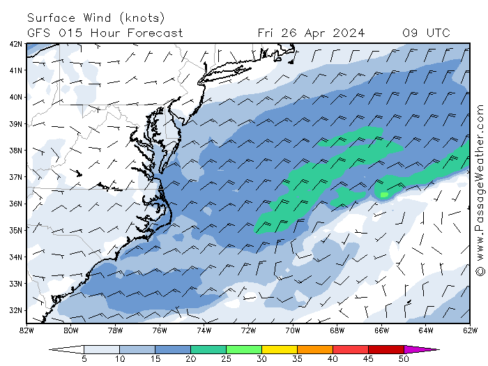 http://passageweather.com/index.htm?...es/mappage.htm Two models, the GFE and NAM are depicted along with wind fields in this figure. If you hit next or animate at the link above, it will show you the predicted tract. NOTE: the maximum wind this map shows is 50 kts even though winds may go much higher both in sustained winds, squalls, tornadoes, etc.As always, these models and actual storm movements will change through time. Still, if you live in predicted effected areas I would take appropriate steps per official instructions in your area to prepare and hope for the best as we do in Florida. Good luck and take care.
__________________
FKA, Inc. transcribed by: Rick Iossi
|
|
#7
08-27-2011, 11:34 AM
|
||||
|
||||
|
http://www.wunderground.com/ Hurricane Irene is moving through North Carolina and a good section of the east coast. Winds are sustained at 85 mph, a lot better than the devastating Cat. 4 conditions predicted not too long ago.  http://intellicast.com/ Winds around 55 mph with a range from about 35 to 80 mph per the record in Buxton on OBX mid morning, see below. Also it could easily go higher than 80 mph in bursts, tornadoes or other isolated squall activity that comes with these things. This storm is different at this point with the northern feeder bands reaching into New England currently have some major squall activity. The plot below that if for Cape Henry, VA at the entrance to the Chesapeake. A squall spiked the wind up from 40 mph to in excess of 65 mph. This will be repeated for the next few days along the areas hit with this bands that are hundreds of miles long. The one that almost killed me was about 450 miles long. So, folks well to the north are already at risk with associated squall activity. Rigged big for lighter conditions between feeder bands, squall spikes the wind and you're screwed, happens way too often. Stay well away from squalls and feeder bands, land and secure early. Better yet, blow off kiting until more consistent conditions return. http://wunderground.com/ Buxton, NC on OBX Cape Henry, VA at the mouth to Chesapeake Bay
__________________
FKA, Inc. transcribed by: Rick Iossi Last edited by ricki; 08-28-2011 at 01:29 AM.
|
|
#8
08-21-2012, 10:32 AM
|
||||
|
||||
|
Tropical Depression 9 is projected to move over South Florida around Sunday or Monday as a hurricane. Heads up, hope it heads into the Atlantic as a fish storm but if not prepare well and early.
__________________
FKA, Inc. transcribed by: Rick Iossi
|
|
#9
06-01-2013, 10:34 AM
|
||||
|
||||
|
I recall bringing this Hurricane resource post back to the top in May one year but I would prefer to ignore it until at least August. Anyway, looks like something might be coming up to the western part of Florida early in thew week from the models. It is forecast to pass over Florida and head out in the Straits and northward.
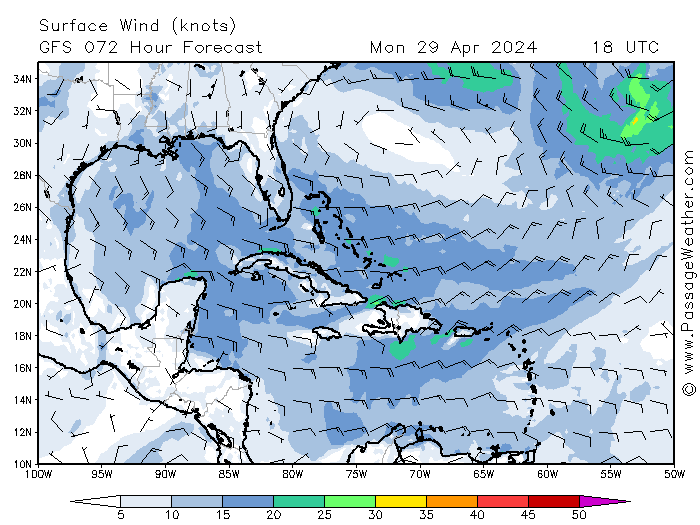 You can step through the model track for this tropical system at the link below. It isn't forecast to turn into a hurricane at this time but will likely bring wind and rain to Florida in the coming week. http://passageweather.com/maps/westindies/mappage.htm A look at the weather from 91L is you are wondering where all the rain is coming from. Hope we have a mild season but monitor the forecasts and prepare as indicated should something threatening come along.
__________________
FKA, Inc. transcribed by: Rick Iossi Last edited by ricki; 06-05-2013 at 07:11 PM.
|
|
#10
06-05-2013, 06:47 PM
|
||||
|
||||
|
Tropical Storm Andrea has formed from the above system and is moving slowly northward pulling squalls and rain storms over Florida.
 http://radar.weather.gov/Conus/southeast_loop.php Here is the current model plot of the forecast track:  http://www.nhc.noaa.gov/ This is what Dr. Jeff Masters has to say about the storm as of 5 pm today: "The Atlantic has its first named storm of the 2013 hurricane season: Tropical Storm Andrea. An Air Force hurricane hunter plane was able to locate a closed center of circulation, and found surface winds of 40 mph in the large area of thunderstorms on the east side of the center. Satellite loops show that Andrea is a lopsided storm. It's center of circulation is exposed to view, due to a large region of dry air that covers the entire Central and Western Gulf of Mexico. This dry air is from a trough of low pressure whose upper level winds are also creating moderate wind shear of 15 - 20 knots over Andrea. Wind shear is forecast to rise to the high range, 20 - 40 knots, by Thursday. Andrea is forecast to make landfall along the northern Gulf Coast of Florida by Thursday evening, so the system has a short window of time to intensify. Given the large amount of dry air to Andrea's west, and the forecast for increasing shear up until landfall, I expect that the strongest sustained winds Andrea could have before landfall are 50 mph. Heavy rains will be the storm's main threat, though a few isolated EF-0 tornadoes will also be possible in some of the heavier thunderstorms in Andrea's spiral bands. A storm surge of 2 - 4 feet is predicted for Tampa Bay northward to Apalachicola, and rip currents will be a risk for swimmers who brave the high surf. Fort Pickens, located in Gulf Islands National Seashore on a barrier island offshore from Pensacola, Florida, has been closed to visitors due to the approaching storm. A single 2-lane road vulnerable to storm surges runs to Fort Pickens. Officials want to prevent a repeat of the situation that occurred in September 2011, when Tropical Storm Lee pushed a storm surge over the road that blocked it with sand and debris, trapping numerous campers and visitors in Fort Pickens. As of 7 pm EDT, our wundermap with the storm surge layer turned on was showing storm surge levels were less than 1 foot along the Florida coast." http://icons.wunderground.com/data/i...model_zoom.gif This is the current marine forecast for Tampa Bay: "Tonight: Tropical storm conditions possible. Southeast winds around 20 knots increasing to 20 to 30 knots with gusts to tropical storm force after midnight. Seas 3 to 5 feet. Bay and inland waters rough. Showers and isolated thunderstorms. Thursday: Tropical storm conditions expected. Southeast winds 30 to 35 knots then becoming south in the afternoon. Seas 6 to 8 feet. Bay and inland waters extremely rough. Showers and isolated thunderstorms. Thursday Night: Tropical storm conditions expected. South winds 30 to 35 knots diminishing to around 20 knots after midnight. Seas 6 to 8 feet. Bay and inland waters extremely rough. Showers in the evening. Isolated thunderstorms. Showers likely after midnight. Friday: Southwest winds around 20 knots with gusts to around 30 knots. Seas 4 to 6 feet. Bay and inland waters choppy. Showers likely in the morning. Isolated thunderstorms. A chance of showers in the afternoon. " http://forecast.weather.gov/MapClick...bw&zmx=1&zmy=1 Substantially higher gusts are possible in squalls which seem to be abundant in this system particularly on the eastern side raking over Florida. There should be heavy rains and high winds for parts of Florida over the next few days.
__________________
FKA, Inc. transcribed by: Rick Iossi Last edited by ricki; 06-05-2013 at 09:14 PM.
|
 |
|
|


 Hybrid Mode
