So, how to try to avoid stuff like this from happening? Wearing reasonable safety gear is always a good idea, physically and mentally rehearsing what to do in a high wind emergency. The BEST thing to do is to work to avoid the hazard in the first place.
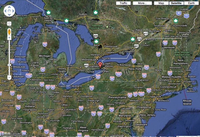
The launch was located along the northern shore of Lake Erie near "A." To makes things more productive, links to weather resources are below each of the figures below for future reference if folks want to try to avoid repeating this accident.
If you have an idea about what sort of weather is expected, when and you pay attention to changes, acting early, you improve the odds of better wind and weather conditions while reducing the chances of tangling with weather hazards. One approach is described below with actual imagery of conditions prior to this sad accident.
So, what winds are forecast, temperatures, CHANGES through the day including wind speed, direction and when, HAZARD forecast at the launch and up weather?
A) WEATHER & HAZARD FORECAST:
http://www.weatheroffice.gc.ca/marin....html?mapID=11
http://www.wunderground.com/cgi-bin/...Select=WEATHER
http://www.weatheroffice.gc.ca/marin....html?mapID=11
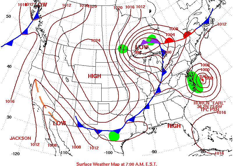 B) WEATHER MAP: http://www.hpc.ncep.noaa.gov/noaa/noaa.gif
A massive cold front had moved east for several days, the blue line.
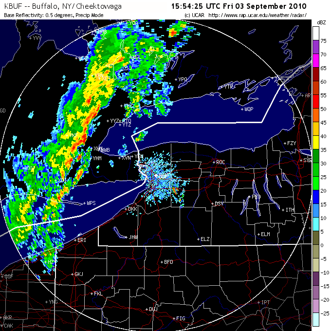 C) RADAR: http://radar.weather.gov/radar.php?r...101111&loop=no
Here is the squall line about FOUR HOURS before the accident with lots of obvious embedded storms. Apparently it had collided with a warm front, occluding it and then there was Hurricane Earl hanging in the ocean just to the east.
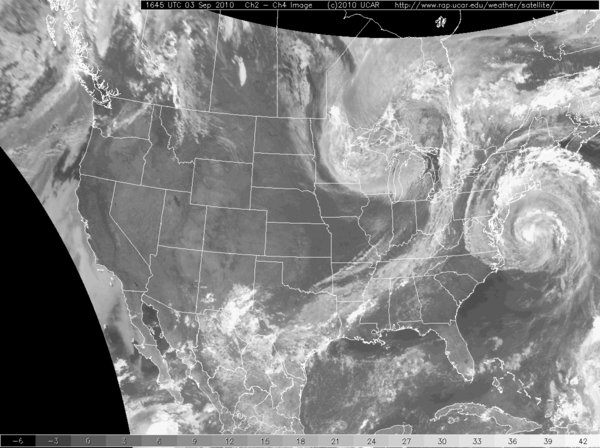 D) SATELLITE: http://www.goes.noaa.gov/ECIR4.html
 (there may be better local images than this for your area)
This shows the size of the cold front and Earl spinning just off to the right.
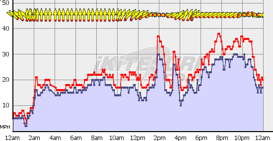 E) REAL TIME WINDS UPWEATHER:
 Finally, here is the wind graph for around the time of the accident from a station about 20 miles to the east. Nice squall spike that approximates the wind gusts estimated at the launch.
Weather planning and monitoring isn't that hard to do. It can improve your quality of riding, reduce idle wind waiting and help to reduce the odds of falling into weather hazards. If you ignore squalls, you are setting yourself up for a real bad situation one of these days. There have been so many avoidable injuries over the years to folks that didn't give weather hazards enough consideration. If you see a squall line, plan to have your kite secured well before it passes over, DON'T plan on riding through it! If you screw up badly and still have your kite as it moves in, Emergency Depower (kill the kite's power fully) and be prepared to set the kite free if it fails to depower properly. Don't stand there waiting for an assisted landing, too many guys have been hurt doing just that. Hope real hard there is no one downwind to be hurt by your kite if you set it free.