SERT Gator, a powerful visualization tool of threat, weather and response
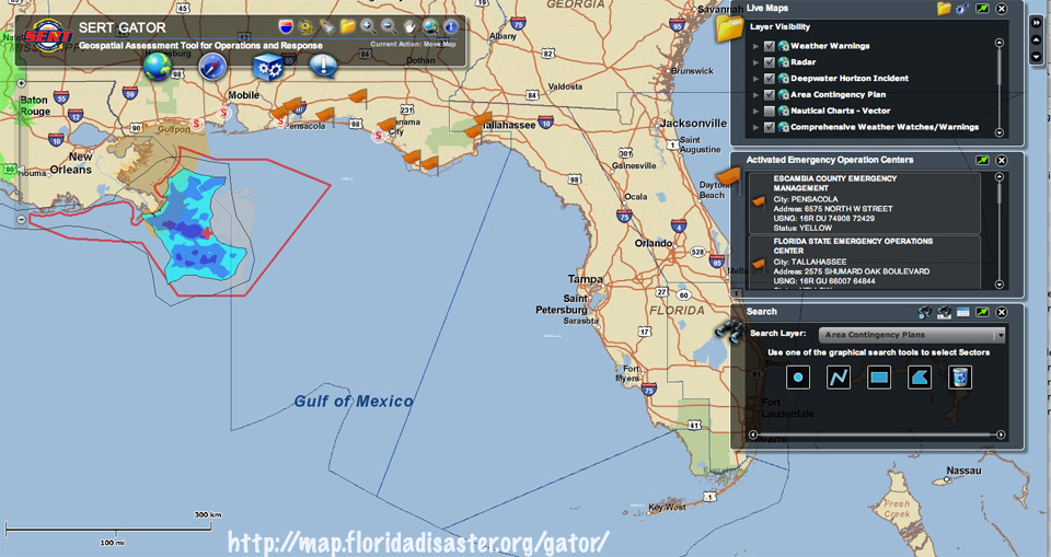 Located at http://map.floridadisaster.org/gator/
The State Emergency Response Team (SERT) have created this nice webpage integrating oil plume, weather and other data, emergency response by sector, search functions and a good deal more on an interactive map platform. Or, in bureau geek-speak: "Flex Viewer to demonstrate the best practice to develop GeoWeb application by leveraging the power of spatial technologies." Click on the earth icon beneath the title to convert it to a satellite map. It was created to deal with emergencies in general, so hurricanes, floods, droughts, fire, etc., you can check them out here and resources to go with. Lots of interesting features on this!
More at:
http://www.floridadisaster.org/eoc/update/home.asp
and
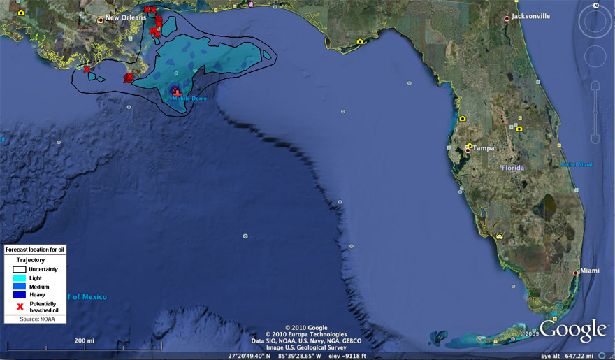
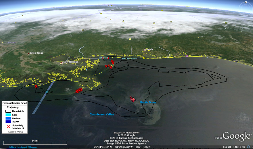
You can see some of this same stuff yourself on google earth. Just click on this flame icon off New Orleans and a window will pop up with several links. It will show you things like size, proximity and landfall of the oil plume:
and
Actual fairly recent satellite imagery of the plume. This is from May 8, 2010. Note the wispy colored features around the release point and extending west, east and north. That is the oil plume.