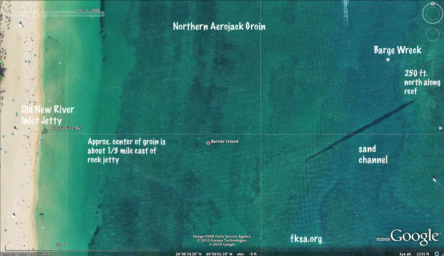
An overview of the layout of things.
Here are the range marks for the barge wreck. The wreck is about 335 ft. north of the jacks on a west facing low reef ledge. This ledge is about 75 ft. west of the seaward end of the Erojack groin.

The west mark for the barge wreck. Just line up the south edge of the Bahia Mar tower with that roof feature of the Sunsentinel building downtown.

The south mark for the barge wreck. Just line up the water tower over the end of the Port Everglades jetty. This mark along with the west mark should drop you right on the barge.

The north marks for the barge wreck. There are two intersections for this one as noted with the "*."
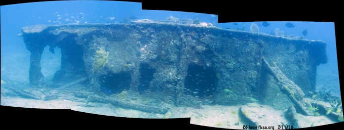
Just aft of the barge bow looking west.
Click photo for full sized image.
Copyright FKA, Inc. 2010
All rights reserved