How to find the jacks and barge? As recent experience has shown, they can be hard to find at times! Range marks should fix that.
If you have a boat with a GPS, you should be able to head to these coordinates. You can check this on google earth.
Nearshore end of Erojacks: 26 06' 37.21" N, 80 05' 57.17" W
Barge wreck: 26 06' 44.40" N, 80 05' 50.55" W
If you don't have a GPS, you can use the following range marks:
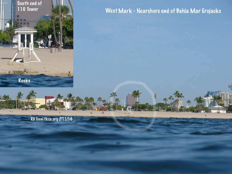
The west mark for the nearshore or western end of the Erojack groin. Line up the former New River Inlet jetty remnants with the south side of 110 Tower. As long as they don't move the lifeguard tower you can use that too but there's a good chance it will be moved. This takes you to the eastern edge of a small reef ledge that drops into the sand channel. You could run out or in on this mark until the north mark intersects. You could track the south mark too but it is less senstive (accurate).
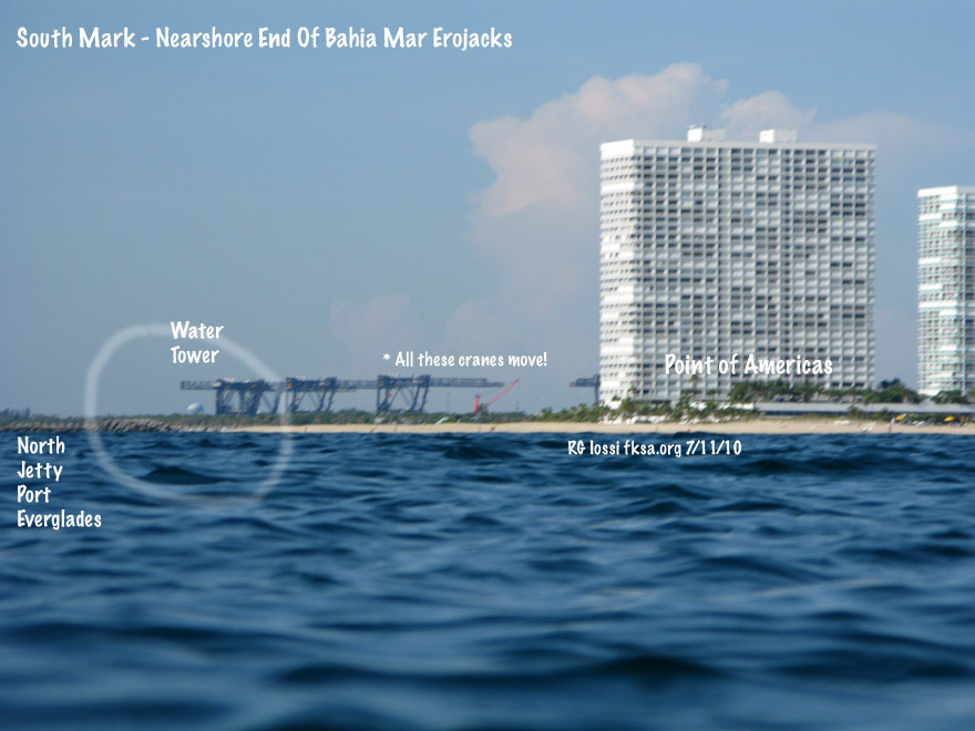
The south mark for the nearshore or western end of the Erojack groin. Try to place the water tower over the western portion of the north jetty to Port Everglades. Thought the container cranes would make nice range points, trouble is they're on tracks and can move a lot! This is a less sensitive range mark than the western or northern marks.

The north mark for the nearshore or western end of the Erojack groin. Just line up the western edge of the building with the third roof feature of the Portofino (?) condo over by Sunrise Blvd..
Copyright FKA, Inc. 2010
All rights reserved.