I just came across an indepth weather analysis of the December 19, 2004 storm event complete with a time plot of wind spikes vs. location, damage, radar images and surface photos.
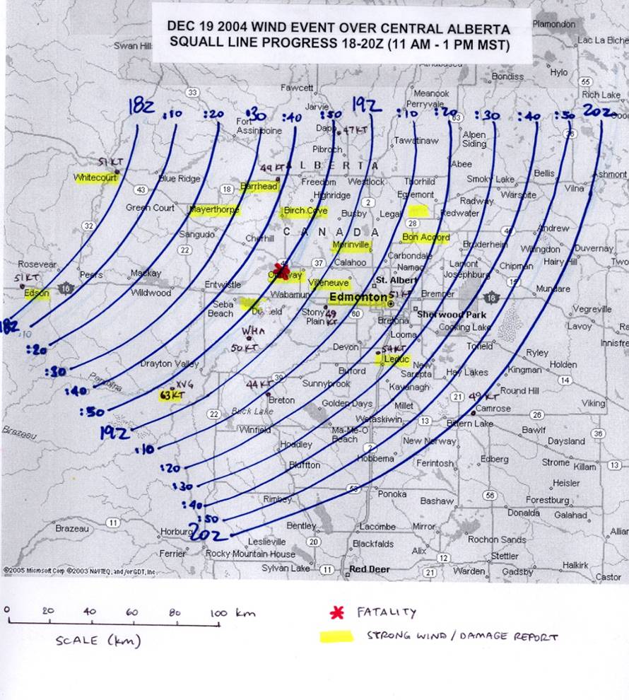
The time series (From**)
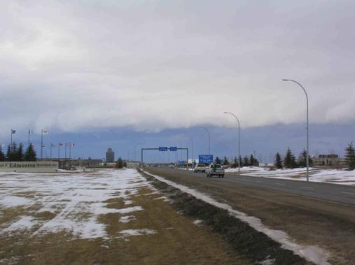
This system generated some dramatic shelf clouds, often assoicated with violent weather (from**)
** For more info:
http://www.umanitoba.ca/faculties/en...torm/main.html